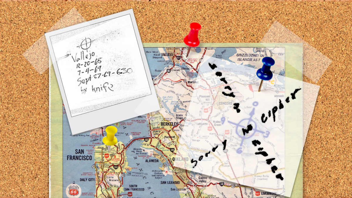
This article explores the hidden meaning behind the map sent to the press by the Zodiac Killer. Drawing upon clues from his Halloween card and other correspondences, this map unveils a possibility the Zodiac Killer was using a map-based methodology.
Overview
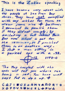
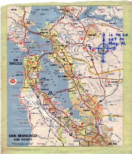
On June 26th, 1970, the Zodiac Killer sent a letter with his Mount Diablo Code and Phillips 66 map, to the San Francisco Chronicle. In this communication, he asserted he had hid a bomb and the citizens of the Bay Area had, “until next fall to dig it up.”
He stated, “The Map coupled with this code will tell you where the bomb is set” (Figure 1).
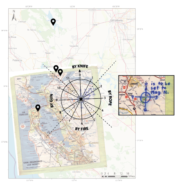
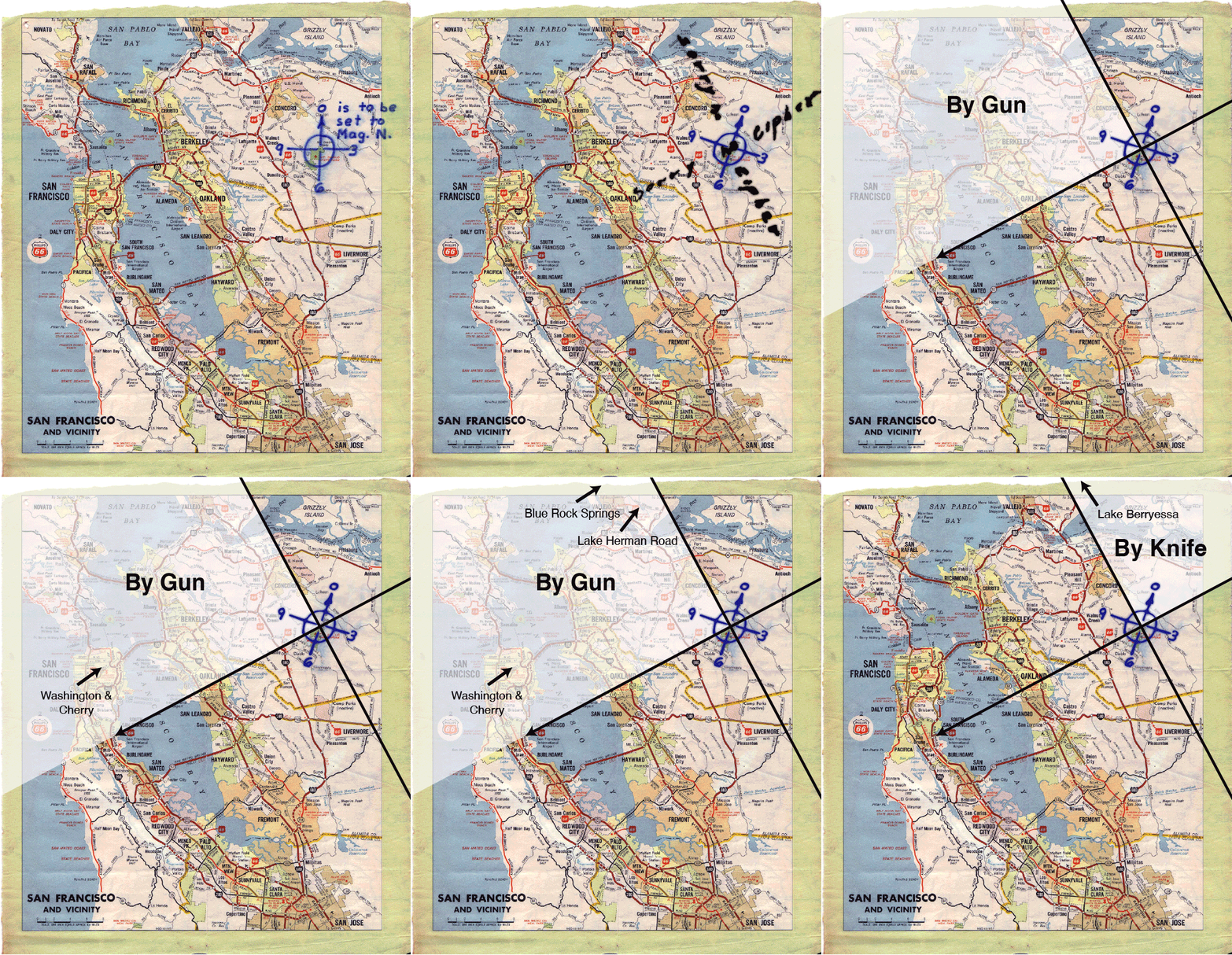
The map features a central marker fixed on Mount Diablo and shows twelve divisions labeled 0, 3, 6, and 9, his only direction to align 0 with ‘Mag. N.,’ an abbreviation for Magnetic North (Figure 2).
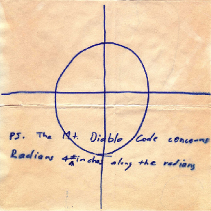
An additional hint to the Zodiac’s map and cipher arrived at the San Francisco Chronicle on July 26th, 1970. His Little List letter was signed off, “PS. The Mt. Diablo Code concerns radians and # inches along these radians” (Figure 3).
Quadrant Theory
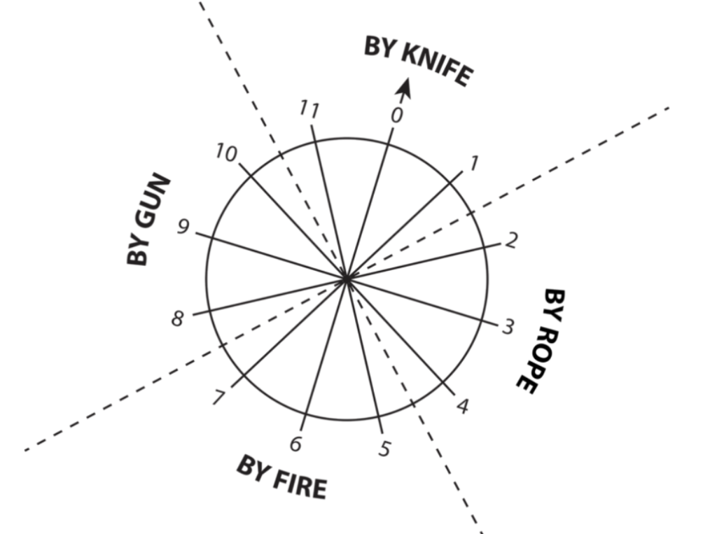
As proposed by Michael Cole in his series, The Zodiac Revisited, Quadrant Theory incorporates the twelve divisions on the map and the four weapons noted on the Halloween card falling into their own quadrants (Figure 4).
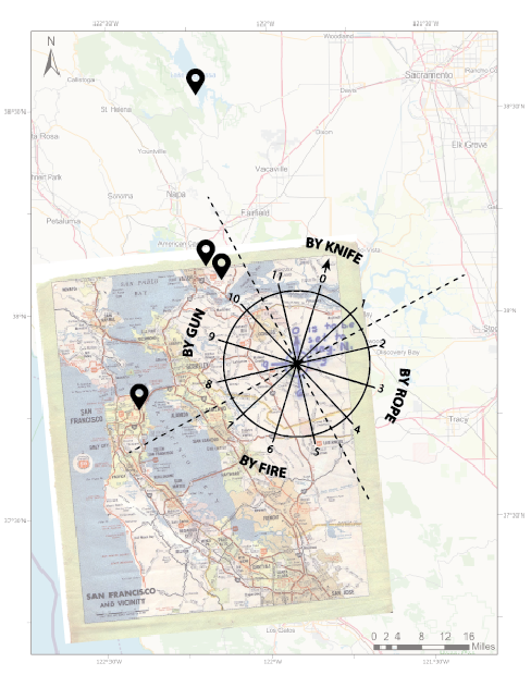
If you set the position indicator to Magnetic North, 17° east of True North at the time, you’d get murders by gun and by knife falling into their own quadrants with the divisions at 45°, 135°, 225°, and 315° (Figure 5). This only works if the position indicator is set to Magnetic North, thus giving purpose to that direction. (Figure 6).
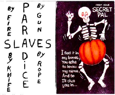
This brings importance to the Halloween card as it shows four weapons in their own quadrants (Figure 7).
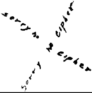
It’s possible the “sorry no cipher” text written in the form of an X hints to this division (Figure 8), as drawing an X through the position indicator after set to Magnetic North would give you these divisions (Figure 9).
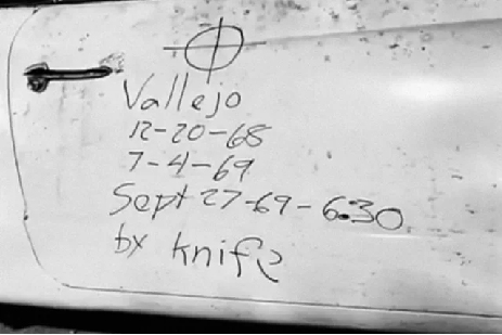
Also supporting the Quadrant Theory is the Zodiac Killer’s act of inscribing ‘by knife’ on the victim’s vehicle at Lake Berryessa (Figure 10).
To explore our ArcGIS map using radians and inches as polar coordinates, visit, ArcGIS Mount Diablo Map.

